
Precision Mapping & Surveying
Survey-grade aerial mapping and 3D documentation for construction, land, and site planning.
We capture high-resolution aerial data and turn it into orthomosaics, 3D models, and decision-ready visuals for planning, documentation, measurement, and stakeholder review.
What This Service Is
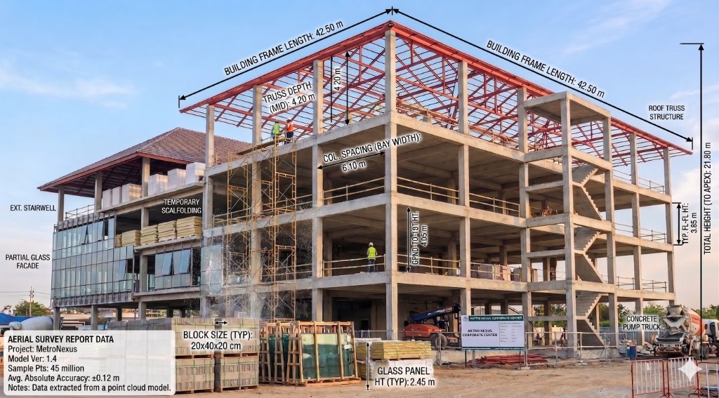
Precision mapping turns drone-captured imagery into accurate, measurable 2D maps and 3D site models. Using RTK-enabled workflows, SkyGrid Imaging delivers dependable visual data for planning, site documentation, measurement, and progress tracking.
Common Applications
Practical use cases for precision mapping & surveying.
Construction site planning
Get a clear, up-to-date view of the site before breaking ground.
Site documentation
Maintain a visual record of existing conditions and boundaries.
Land development overview
Evaluate topography and site context for upcoming projects.
Pre-project conditions
Document the exact state of a property to mitigate liability.
Progress support
Overlay design plans onto current aerial maps to verify alignment.
Stakeholder communication
Share easily understandable visual maps with investors and teams.
Typical Deliverables
Example project outputs you can expect to receive.
Example Project Package
Typical deliverables for a precision mapping & surveying engagement.
Included Outputs
- Orthomosaic site map
- 3D site model
- High-resolution aerial imagery
- Web-shareable viewer access
- Organized cloud delivery
Best For
- construction planning
- existing site documentation
- land development overview
- stakeholder review

3D Site Model
A navigable textured mesh model allowing you to view the site from any angle and understand spatial relationships.

High-Resolution Aerial Imagery
Organized folders of the raw, high-quality nadir and oblique photographs captured during the flight.

Annotated Map Exports
Export specific measurements, area highlights, and notes as shareable PDFs or image files for project meetings.

Web-Shareable Deliverables
Links to view and measure maps directly in your browser without specialized software.
Why SkyGrid?
Professional focus, reliable outputs.
RTK-Enabled Workflows
We utilize survey-grade positioning to ensure data accuracy and reliability.
Repeatable Methods
Automated flight paths allow us to capture the exact same data week over week.
Clear Visual Outputs
We prioritize deliverables that are easy for your entire team to understand and use.
Organized Delivery
No messy file dumps. Everything is securely delivered via our structured cloud portal.
Arizona-Based Service
Local expertise serving Arizona and select regional commercial projects.
Ready to See Your
World in Detail?
Tell us about your project. We'll scope it, fly it, and deliver precision data you can act on.